
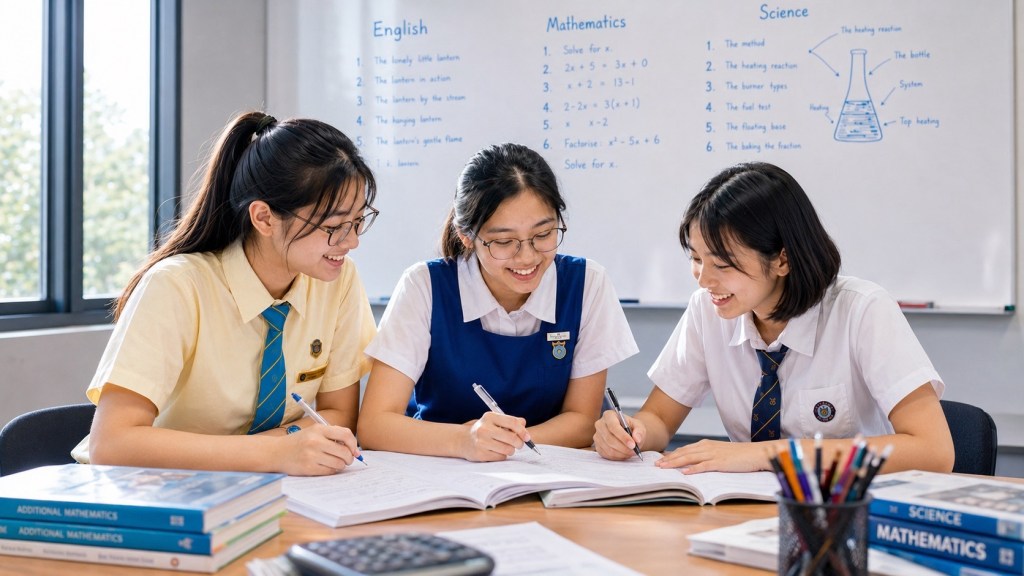
Sengkang is one of those places that becomes more interesting the longer you look at it. At first glance, it is a young HDB town in north-eastern Singapore: homes, schools, an MRT station, two LRT loops, shopping centres, sports facilities, parks and the familiar rhythms of family life. Look again and another Sengkang appears beneath it — an older landscape of rivers, fishing villages, plantations and working ground. Look forward and yet another Sengkang is taking shape through transport upgrades, new community facilities, ageing-in-place housing, stronger links across the north-east and a town centre that is still being reconsidered for the next generation.
So, what about Sengkang?
The answer is larger than “a residential town”. Sengkang is a living system: homes connected to schools; schools connected to families; families connected to rail and bus networks; neighbourhoods connected by the LRT; parks connected to rivers and park connectors; learning connected to daily life; and all of it sitting inside a town that has moved from Kangkang and plantation country to a mature 21st-century heartland in barely a generation.
This page is the eduKate Sengkang apex hub for Sengkang itself. It does not replace the specialist Learning Hall, Science Hub, Computing Hub, parent guides or tuition routes already on this site. Those pages keep their jobs. This hub does something different: it shows how the town, the learner and the education ecosystem fit together.
Sengkang is not simply where learning happens.
It is one of the things a learner can learn to read.
What Is Sengkang? A Quick Answer
Sengkang is a major HDB town in north-eastern Singapore organised around Sengkang Town Centre, the North East Line, the Sengkang LRT network and four main neighbourhood identities: Rivervale, Compassvale, Anchorvale and Fernvale. Buangkok, immediately to the south and closely integrated into daily Sengkang life, has become an increasingly important second activity node through Sengkang Grand Mall, Buangkok MRT and the Buangkok Integrated Transport Hub.
Its history is older than its skyline. HDB records that Sengkang was once occupied by fishing villages and rubber and pepper plantations. The town design history also preserves the earlier name Kangkang, associated with settlements near Sungei Serangoon and Sungei Punggol. The modern name Sengkang means “prosperous harbour” in Chinese, carrying a deliberate echo of that earlier waterside history into the new town.
Sengkang was also unusual in the way transport and housing were planned together. HDB notes that it was the first satellite town to have major public transport amenities developed in tandem with the main public-housing programme. The Sengkang LRT opened in 2003 and today serves 14 stations across two loops, connecting neighbourhoods back to Sengkang MRT and the town centre.
That gives Sengkang several identities at once: river town, transport town, family town, education town, mature new town and evolving regional connector.
Sengkang in one table
| Layer | Sengkang expression | Why it matters |
|---|---|---|
| History | Kangkang, fishing villages, rubber, gambier and pepper plantations | The modern town sits on an older working landscape |
| Home | Rivervale, Compassvale, Anchorvale, Fernvale and the wider Buangkok interface | Neighbourhood identity shapes daily routes and community life |
| Water | Sungei Punggol, Sungei Serangoon and reservoir-edge landscapes | Rivers are part of Sengkang’s history, ecology and public realm |
| Nature | Sengkang Riverside Park, wetlands and park connectors | Dense housing remains connected to real ecological systems |
| Movement | NEL, Sengkang LRT, buses, cycling and walking networks | Transport determines the practical size of the town |
| Community | Town centre, neighbourhood centres, Sengkang Grand Mall, libraries and public facilities | A town becomes home through repeated shared use |
| Learning | Schools, families, tuition, Science Hub, Learning Hall and Computing Hub | Education stretches beyond lessons into a complete learning environment |
| Future | Town-centre community-hub study, rail upgrades and stronger north-east connectivity | Sengkang is mature enough to require renewal, not merely expansion |
How to Use This Sengkang Hub
A large education estate becomes useful only when a reader can tell which page should answer which question. This hub therefore works as a switchboard rather than a replacement.
- For the mechanism of learning itself, start with How Learning Works | The eduKate Sengkang Mechanism Map.
- For parents deciding what support a child needs, use the Parents’ Guide to eduKate Sengkang.
- For Primary 1 to Primary 6 tuition routes, enter Primary Tuition Sengkang.
- For Secondary 1 to Secondary 4 routes, enter Secondary Tuition Sengkang.
- For English, use English Tuition Sengkang.
- For Mathematics, use Mathematics Tuition Sengkang.
- For Primary Science tuition, use Primary Science Tuition Sengkang; for the larger science estate, use the Science Hub.
- For computing and systems thinking, use the Algorithms & Computing Hub.
- For the wider Learning Hall and its values, enter I Am Brave.
- For the complete learner-routing system, use Learning Atlas V2.0.
- For Primary-school locality and school-specific learning guides, use Primary Schools in Sengkang.
- For Secondary-school locality, Full Subject-Based Banding and SEC-aware school routes, use Secondary Schools in Sengkang.
- For tuition decisions shaped by Sengkang MRT, Compass One, Buangkok and door-to-door travel, use Tuition in Sengkang: How to Compare It.
- For study environment and Sengkang Public Library, use Study Spots in Sengkang.
- For Sengkang as a town — its history, rivers, neighbourhoods, transport, parks, families and future — stay on this page.
The principle is simple: the hub tells you where you are; the specialist page tells you what to do next.
Contents
- Sengkang as a connected system
- Kangkang, fishing villages and the older landscape
- How the modern town was given an identity
- Rivervale, Compassvale, Anchorvale, Fernvale and Buangkok
- The rivers beneath the town story
- Sengkang Riverside Park and the wetland
- MRT, LRT, buses, walking and cycling
- Why Buangkok changes the southern edge of Sengkang
- How a town becomes community
- The next Sengkang Town Centre
- Sengkang as a learning environment
- Primary 1–6 learning route
- Secondary 1–4 learning route
- English, Mathematics, Science and Computing
- Parents, tuition and the right intervention
- Sengkang itself as a classroom
- Sengkang in the next decade
- What should Sengkang protect while it changes?
- The Sengkang Library of Routes
- Frequently asked questions
- Official sources and fact-checking
Sengkang Is Better Understood as a Connected System
A town can be described by inventory. Count the flats. Name the schools. Mark the stations. List the malls. Add the parks. That gives us a map.
But maps do not automatically explain how a place works.
Sengkang becomes clearer when we ask about relationships. A school affects the morning peak. An LRT station affects which routes feel walkable. A neighbourhood centre affects how often families need to leave the precinct for daily needs. A river shapes land use. A wetland changes biodiversity. A library changes what a town can offer a child on a rainy afternoon. A bus interchange changes the number of transfers required to reach work. A new community hub can change whether healthcare, sport, shopping and public activity occupy separate errands or one connected trip.
In other words:
Sengkang = home + movement + water + community + learning + time.
The last word matters. A well-functioning town gives time back. It shortens the unnecessary trip. It places useful things near one another. It allows children to move progressively more independently. It gives parents fewer logistical knots to untie. It lets older residents remain active closer to home. It creates public places that are worth staying in, not merely passing through.
That is also why education belongs inside a town hub. A student’s performance is not produced inside a vacuum. Sleep, commute, family rhythm, school distance, after-school travel, access to libraries and parks, concentration, stress, friendship and routine all become part of the learning system.
Before Sengkang Was Sengkang: Kangkang, Fishing Villages and Plantations
The modern town is young enough that many residents remember when large parts of it were still under construction. That recency can create the illusion that Sengkang itself has little history.
The opposite is true.
HDB’s current town history records that the area was once occupied by fishing villages as well as rubber and pepper plantations. HDB’s Sengkang Town Design Guide goes further, explaining that the area was formerly known as Kangkang, a name associated with the “foot of the port”, with fishing villages along Sungei Serangoon and Sungei Punggol and plantation estates inland where rubber, gambier and pepper were cultivated.
These were not decorative historical details. They describe an economy. Water meant transport, food and livelihood. Plantations meant land, labour and trade. Tracks and roads connected productive ground to wider markets. The old landscape was already a system long before the new town arrived.
The name Sengkang preserved a version of that memory. HDB describes it as meaning “prosperous harbour” in Chinese. The choice was forward-looking and backward-looking at the same time: an aspirational name for a new satellite town that still carried the harbour idea of the old riverside settlements.
That is worth remembering because new towns can otherwise feel as though history begins with the first BTO launch. It does not. Concrete is one geological layer in the human story of a place.
How the Modern Town Was Given an Identity
Sengkang was not developed as an accidental accumulation of blocks. Its town identity was deliberately designed around its relationship with water and its older working landscape.
The HDB Town Design Guide divides the town’s broad design language into two complementary ideas. Rivervale, Compassvale and Anchorvale form an “Urban Harbour” identity, recalling the fishing-village heritage and the more active urban heart of the town. Fernvale is associated with a “Flourishing Grove” identity, drawing on the plantation landscape and a more rustic memory.
You can see the harbour idea in the language of the place. Compassvale. Rivervale. Anchorvale. Names are not infrastructure, but they can make a town legible. A child who grows up with “Anchor”, “Compass”, “River” and “Sengkang” in everyday addresses is living inside a quiet layer of historical storytelling.
Good town identity works best when it is not costume. It should help different neighbourhoods feel related without forcing them to look identical. Sengkang’s challenge now is the challenge of every maturing new town: retain enough common language that the town feels whole while allowing neighbourhoods to age, improve and develop their own character.
Rivervale, Compassvale, Anchorvale, Fernvale and the Buangkok Interface
People rarely live in “Sengkang” at the scale planners draw it. They live in a particular walking radius.
One family’s Sengkang is Rivervale and the East Loop. Another family’s Sengkang is Anchorvale, the sports facilities and the river. Another is Fernvale, Kupang and the western edge. Another revolves around Compassvale, Sengkang Town Centre and the MRT. Increasingly, another daily map is anchored at Buangkok and Sengkang Grand Mall.
Rivervale
Rivervale forms the eastern side of the mature town and is strongly tied to the Sengkang LRT East Loop. Its name reinforces the riverine identity of Sengkang. In practical terms, neighbourhood life is structured around schools, local retail, LRT access and the route back to the central MRT interchange.
Compassvale
Compassvale sits close to the town’s transport and commercial core. The “compass” language is unusually appropriate for a town whose daily movement radiates through Sengkang MRT, the bus interchange and the LRT loops. Compass One and the public library add a strong learning-and-community layer to the town centre.
Anchorvale
Anchorvale stretches toward Sengkang Riverside Park and has a strong recreation and river relationship. It is where the town’s nautical language becomes physically visible: homes, community facilities and active-life infrastructure sit close to the water and park system.
Fernvale
Fernvale carries the “Flourishing Grove” idea in the western side of Sengkang. It has matured rapidly through new housing, Seletar Mall, neighbourhood facilities, LRT access and successive BTO projects. HDB’s newer planning also places one of Singapore’s Community Care Apartments projects within Fernvale Heights, strengthening the idea that the town must now plan not only for young families but also for residents who wish to age in place.
Buangkok
Buangkok complicates neat planning boundaries in a useful way. Residents do not experience town lines as sharply as maps do. The Buangkok MRT area, Sengkang Grand Mall and the Integrated Transport Hub now serve as a major activity node for the southern Sengkang population and adjacent neighbourhoods.
This is a useful reminder: functional geography is often more important than administrative geography. People organise life around time and convenience. The place that is easiest to reach becomes part of the practical town.
The Rivers Beneath the Town Story
Sungei Punggol and Sungei Serangoon are not background scenery in the history of Sengkang. They are part of the reason the older settlements existed where they did.
Rivers organise landscapes before planners arrive. They shape movement, soil, ecology, settlement and work. Even when the modern town introduces reservoirs, bridges, roads and housing, the old water logic remains present.
For a modern resident, water changes the sensory experience of a dense town. A river gives the eye distance. It creates a continuous edge for walking and cycling. It supports habitats that cannot exist in the same way inside a paved plaza. It changes wind, shade, sound and the rhythm of movement.
For a student, the river is also an invitation to systems thinking. Water does not recognise subject boundaries. Geography asks where it flows. Science asks what lives in it and how water quality changes. Mathematics asks about volume, rate, gradient and measurement. History asks who depended on it. Civics asks how public access and ecological protection should be balanced.
Sengkang Riverside Park: When Ecology Becomes Part of Everyday Town Life
Sengkang Riverside Park is one of the places where the town’s old river identity and modern recreational system meet most clearly.
NParks lists the park at 21.3 hectares, at the junction of Anchorvale Street and Sungei Punggol. The park sits on the North Eastern Riverine Loop and the Round Island Route. It contains one of Singapore’s largest man-made wetlands, alongside boardwalks, cycling connections, fruit trees and habitat for birds, dragonflies and damselflies. The 290-metre Sengkang Riverside Bridge connects the park’s banks and Punggol Reservoir.
The wetland is especially important as an educational object because it looks quiet while doing many jobs. Wetlands filter, retain, slow, host, cool and connect. They are infrastructure that happens to be alive.
That phrase — infrastructure that happens to be alive — is useful for children. It prevents the false separation between “nature” and “the city”. The best urban systems often make the two cooperate.
A family walking through the park may be exercising, spending time together and moving between neighbourhoods. At the same moment, the wetland is supporting biodiversity, the river is carrying water through a larger catchment system, and the park connector is functioning as an active-mobility route. One place, many functions.
MRT, LRT, Buses, Walking and Cycling: The Geometry of Daily Sengkang
Transport changes how large a town feels.
Two homes can be one kilometre apart and feel disconnected if the pedestrian route is poor. Two neighbourhoods can be several kilometres apart and feel close if the LRT is reliable. The useful measure of distance is therefore not only metres. It is friction.
The North East Line
Sengkang MRT connects the town directly to the North East Line and gives the neighbourhood rail system a strong central anchor. The NEL turned Sengkang from an outer new town into a place with direct rail access through Hougang, Serangoon, Little India, Dhoby Ghaut and the city.
The Sengkang LRT
The Sengkang LRT is fundamental to the shape of the town because it was planned together with Sengkang’s public-housing growth. LTA states that the system opened in 2003 and now serves 14 stations across two loops. Its job is local circulation: collect residents from neighbourhoods and return them to the town centre, MRT and bus network.
Both the Sengkang and Punggol LRT systems were upgraded from one-car to two-car operations in 2016. LTA is continuing the Sengkang-Punggol LRT upgrading programme, including adding more two-car trains and expanding the depot by 2027 to support long-term demand.
This is an example of a mature infrastructure problem. Building a new system is one challenge. Keeping it useful as the town grows is another. Capacity, reliability, maintenance access, passenger flow and future demand become the questions of adulthood for a transport network.
Walking and cycling
The rail network works best when the first and last kilometre are comfortable. Park connectors, covered walkways, crossings, cycling routes and neighbourhood permeability determine whether residents can use public transport without turning every short connection into a second transport problem.
Sengkang Riverside Park’s position on the North Eastern Riverine Loop and Round Island Route makes this especially visible. Recreation infrastructure becomes mobility infrastructure when it actually connects useful destinations.
Buangkok Integrated Transport Hub: A Second Centre of Everyday Gravity
Buangkok’s role in daily Sengkang life changed significantly with the opening of the new bus interchange on 1 December 2024.
LTA describes Buangkok as Singapore’s 12th Integrated Transport Hub, linking the bus interchange directly with Sengkang Grand Mall and Buangkok MRT station. The interchange opened with Services 110, 114 and 156 and was designed to accommodate seven bus services as routes are progressively added.
The significance is not the number twelve. It is the reduction of transfer friction.
A good integrated transport hub takes activities that would otherwise be separate — train, bus, food, groceries, community facilities, childcare, public space — and layers them into one destination. A parent can solve several small problems in one journey. A commuter can transfer without crossing a hostile road. A child can recognise the place as a stable landmark in the mental map of the neighbourhood.
URA describes Sengkang Grand Mall as an integrated development combining a shopping mall, hawker centre, community club, childcare centre, playground, bus interchange and public spaces. That mixture explains why the development functions as more than retail. It is a community intersection.
How a Town Becomes Community
Housing can be completed on a schedule. Community cannot.
Community grows through repetition. The same neighbour appears at the lift. The same children cross paths at the playground. Parents recognise one another at the school gate. Teenagers occupy the same library tables. Older residents develop a preferred walking route. Shopkeepers become familiar faces. A hawker knows the order before it is spoken.
These encounters are small, which is exactly why they matter. Trust is often built before anyone consciously decides to build it.
Sengkang’s public architecture therefore matters at several scales:
- Town centre: where transport, retail, library and civic activity overlap.
- Neighbourhood centres: where everyday needs can be solved without leaving the local area.
- Parks and connectors: where residents encounter one another outside formal institutions.
- Schools: which are education institutions and also powerful neighbourhood anchors.
- Community clubs and public programmes: which give strangers a reason to become participants.
- Integrated developments: which reduce the distance between transport, food, care, services and public life.
The design question is not simply “How many facilities?” It is “Do these facilities create a life that joins up?”
The Next Sengkang Town Centre: From Transport Node to One-Stop Community Hub
Sengkang has reached the stage where the important planning question is no longer only how to add more homes. It is how to renew and deepen a town centre that already serves a large mature population.
Under the Master Plan 2025 work for the North-East, URA says Sengkang Town Centre could become more vibrant through an integrated community hub featuring commercial, healthcare, sports and recreation facilities connected seamlessly to Sengkang MRT Station.
The wording matters: this is a planning direction under study, not a promise that every detail is fixed. But the direction tells us something important about how Singapore is thinking about mature heartlands. The next generation of town improvement may come less from isolated new buildings and more from combining functions intelligently around transport nodes.
That model makes sense for a family town because families live in bundles of needs. A Saturday is rarely “sport only”. It may involve tuition, groceries, lunch, a clinic visit, library books, a child’s activity and a train journey. When services are fragmented, families pay in time. When compatible services are integrated, the town returns time.
Sengkang as a Learning Environment
eduKate Sengkang is built around a simple idea: learning is not the same thing as receiving information.
A learner must notice, understand, practise, retrieve, connect, apply, test, correct and eventually operate with less help. That full mechanism is mapped in How Learning Works | The eduKate Sengkang Mechanism Map.
The town itself can support that mechanism when families use it deliberately.
- A library supports reading, quiet work and information search.
- A park supports movement, recovery, observation and real-world Science.
- A train map supports route planning, estimation and network thinking.
- A wetland supports systems thinking and ecological observation.
- A neighbourhood centre supports independence as a child grows older.
- A town under renewal gives students real topics for argumentative writing.
- A mixed transport network gives Mathematics a living context in time, rates, frequency and optimisation.
This does not mean every outing must become a lesson. That would make childhood exhausting. It means a good learner gradually discovers that knowledge is not trapped inside the worksheet.
That is the deeper role of the eduKate Sengkang Learning Hall: build courage, capability and independence so knowledge can travel with the student into the world.
Primary 1–6 in Sengkang: Building the First Learning System
Primary school is often described as six levels. It is more useful to see it as six stages of one accumulating system.
Primary 1 begins with supported routines. Primary 2 asks those routines to become more independent. Primary 3 expands the academic world, including formal Science. Primary 4 deepens reasoning. Primary 5 increases complexity and reveals weak foundations. Primary 6 compresses years of learning into PSLE execution while preparing the child for the structural change of Secondary school.
The main owner page is Primary Tuition Sengkang | P1–P6 Learning Progression, Subjects & Parent Guide.
Primary level routes
- Primary 1 Tuition Sengkang | Building the First Learning System
- Primary 2 Tuition Sengkang | From Supported Learning to Independent Foundations
- Primary 3 Tuition Sengkang | The First Big Academic Expansion
- Primary 4 Tuition Sengkang | From Foundations to Upper-Primary Reasoning
- Primary 5 Tuition Sengkang | Building the PSLE Engine Before the Final Year
- Primary 6 Tuition Sengkang | PSLE Readiness, Exam Control & the Secondary Transition
The important word is progression. A Primary 5 problem may have begun in Primary 3. A Primary 6 comprehension problem may be partly vocabulary, partly inference, partly reading stamina and partly exam execution. A child does not reset at the start of each school year. The system carries history.
Secondary 1–4 in Sengkang: The Learning System Becomes More Demanding
Secondary school changes the structure of learning.
There are more teachers, more subjects, more abstraction, more independent organisation and larger differences between what students know and what examinations require them to do under time pressure. The child who could compensate for weak habits in Primary school may discover that the system no longer forgives those weaknesses so easily.
The main owner page is Secondary Tuition Sengkang | Sec 1–4 Learning Progression, Subject Levels & Examination Pathways.
Secondary level routes
- Secondary 1 Tuition Sengkang | The Primary-to-Secondary Learning Reset
- Secondary 2 Tuition Sengkang | Consolidation, Subject-Level Growth & Upper-Secondary Readiness
- Secondary 3 Tuition Sengkang | Upper-Secondary Specialisation & SEC Readiness
- Secondary 4 Tuition Sengkang | Graduation-Year Learning, Exam Control & the SEC Transition
Secondary 1 is especially important because transition reveals hidden dependencies. Secondary 2 is where habits either stabilise or drift. Secondary 3 introduces sharper specialisation and greater examination pressure. Secondary 4 is not simply “more of Secondary 3”; it is a graduation year in which content, exam control and post-secondary decisions converge.
English, Mathematics, Science and Computing in Sengkang
The subject hubs remain canonical owners. This Sengkang page provides the town-level route into them.
English: the operating language of learning
English is examinable, but its educational role is larger than one subject grade. It is also the language through which students interpret instructions, explain reasoning, distinguish claims, understand Science questions and communicate mathematical thinking.
A student who cannot read precisely may appear weak in several subjects at once. That is why the main route, English Tuition Sengkang | Find the First Weak Link, begins with diagnosis rather than generic practice.
The deeper English estate then widens into grammar, vocabulary, inference, argument, narrative, multimodal reading, precision, rhetoric and the structure of meaning itself.
Mathematics: the structure beneath the answer
Mathematics rewards answers, but it is built from relationships. Students need number sense, algebraic control, representation, pattern recognition, proportional reasoning, geometry, probability, functions and the habit of checking whether a result makes sense.
The main route is Mathematics Tuition Sengkang | Find the First Weak Link. For upper-secondary progression, the Secondary Mathematics Sengkang S1–S4 Capability Map shows how mathematical capability accumulates across levels.
Science: learning to make claims answerable to evidence
Science is where curiosity learns discipline.
A good scientific explanation is not merely confident. It is constrained by observation, measurement, mechanism, evidence and the limits of the model being used. That is why eduKate Sengkang separates the practical tuition route from the larger science knowledge estate.
For Primary tuition, use Primary Science Tuition Sengkang | P3–P6 Learning System. For the full subject world, enter the Science Hub | Learn Science from First Curiosity to Research, supported by the Complete Science Index.
Computing: from instructions to systems
Computing is often introduced through code, but code is the visible surface of a deeper world: algorithms, representation, state, data structures, abstraction, interfaces, optimisation, error handling and systems design.
The Algorithms & Computing Hub | From First Principles to Professional Systems gives that subject its own route rather than forcing it into Mathematics or Science. The Complete Algorithms & Computing Index widens the map when a learner is ready.
Parents, Tuition and the Right Intervention
Parents usually do not begin with an academic theory. They begin with a child in front of them.
“She studies, but nothing stays.”
“He understands in class but cannot do the paper.”
“Her marks fell after moving to Secondary 1.”
“He is doing well. How do we stretch him without making him miserable?”
Those are different problems. They should not receive the same intervention.
The Parents’ Guide to eduKate Sengkang exists to help families distinguish the possible causes before adding more activity.
A stronger decision sequence
- Observe the evidence. Use actual work, school feedback and marked papers rather than anxiety alone.
- Locate the first weak link. Is the issue knowledge, reading, memory, execution, organisation, confidence, time control or something else?
- Match the intervention. Not every problem needs tuition. Some need better practice, sleep, routine, teacher clarification or a more realistic workload.
- Define what improvement would look like. A useful intervention has an observable target.
- Review. If the problem is not changing, the plan should change.
This is also the meaning behind What Does “We Take the Stress Away” Mean at eduKate Sengkang?. Lower stress does not mean lower standards. It means reducing unnecessary uncertainty so effort can be directed at the actual problem.
Sengkang Itself Can Be a Classroom
A town becomes educationally powerful when students learn to ask questions of familiar things.
Geography
Why did older settlements form beside rivers? How does a satellite town organise housing, schools, transport and commercial centres? What is the difference between a neighbourhood centre and a town centre? How does the LRT change land-use possibilities? Why do mature towns need renewal as well as expansion?
Science
What does a constructed wetland do? Why are dragonflies associated with particular habitats? How does water quality affect biodiversity? What are the trade-offs between access and conservation? How do trees, water and built surfaces change local heat conditions?
Mathematics
How much time does a transfer add to a journey? What is the average waiting time if a service has a known frequency? How does a two-loop LRT network change route choice? How could pedestrian distance be modelled? What does “capacity” mean for a rail system? How do percentages distort perception when absolute numbers are small?
English
Is an “integrated hub” automatically better than separate facilities? What makes a good neighbourhood? Should historical names influence new development? Is convenience enough to define liveability? What should Sengkang preserve as it renews? These are real argumentative questions with genuine competing values.
Computing and systems
A transport network can be represented as nodes and edges. A timetable is a scheduling problem. Passenger demand is a data problem. A route planner is an optimisation problem. A lift, gantry or station display is an interface problem. A fault is an error-handling problem. Suddenly a familiar town becomes a systems laboratory.
Civics
Every town decision has multiple legitimate objectives. Residents want convenience, affordability, greenery, connectivity, quiet, housing supply, healthcare, safety and community space. Land is finite. Budgets are finite. Construction creates disruption. The civic skill is not to pretend trade-offs do not exist. It is to reason about them fairly.
Sengkang in the Next Decade: A Mature New Town Learns to Renew Itself
There is a stage in a town’s life when “new town” stops being a useful description.
Sengkang is entering that stage.
Its earliest modern residents have lived through the construction of the LRT, the opening of the North East Line, waves of school growth, new neighbourhoods, major medical and recreational facilities, retail expansion and the maturation of a generation born into the town. The next decade will therefore not feel like the first decade.
The future work is more subtle:
- Renew the town centre without making it harder to use during the transition.
- Increase transport capacity and reliability as travel demand evolves.
- Strengthen ageing-in-place options as the first large cohorts of residents grow older.
- Preserve useful ecological and recreational corridors while accommodating changing housing needs.
- Improve first-and-last-mile movement so public transport remains genuinely convenient.
- Keep the town legible as older neighbourhoods and newer integrated developments coexist.
- Build public spaces worth staying in, not only efficient passages between commercial functions.
LRT upgrading is a future story too
LTA’s ongoing Sengkang-Punggol LRT programme demonstrates a mature-town principle: infrastructure must be renewed before failure forces renewal. More two-car trains and depot expansion are not glamorous in the way a completely new line is glamorous. They are the work required to keep an existing system useful.
The wider north-east is also changing
Sengkang does not develop alone. Punggol Digital District, Punggol Coast, the Cross Island Line and the wider north-east planning programme will change travel patterns, job geography and the number of destinations that feel “near”. The Cross Island Line–Punggol Extension, currently targeted for 2032, includes an interchange at Riviera, creating a new east-west connection that will matter to parts of Sengkang even though the line is not centred on Sengkang Town Centre.
The practical geography of north-eastern Singapore is therefore becoming more networked. Punggol and Sengkang will remain distinct towns, but the spaces between them will feel less like edges and more like connections.
What Should Sengkang Protect While It Changes?
Renewal is necessary. So is restraint.
The most useful question is not “How do we stop change?” It is “What becomes difficult to recover once lost?”
Protect the river memory
Sengkang’s harbour language should remain more than a branding exercise. The rivers, wetlands and historical story give the town depth. A place is richer when residents know why its names exist.
Protect ecological function
The wetland and river system should be valued for what it does, not only how it photographs. Biodiversity, water movement and habitat continuity are part of the town’s long-term infrastructure.
Protect human-scale routes
A mature town can become more congested even while transport improves. Good walking, cycling, shade and crossings are essential because every public-transport journey begins and ends as a human body moving through space.
Protect time for children
Sengkang is a family town. Family towns can become heavily scheduled towns. Children need strong education, but they also need unsupervised thinking, movement, reading, play, friendships and moments when nothing is being measured.
Protect mixed generations
The first generation that moved into a young Sengkang is ageing. A good mature town does not quietly become inconvenient for the people who helped make it home. Housing, transport, care and public space must remain usable across life stages.
Protect the ability to change again
The future will surprise current planners. Flexible public spaces, adaptable buildings, strong transport, interoperable systems and healthy community institutions are valuable partly because they can support needs that do not yet have names.
The Sengkang Library of Routes
This is the curated spine beneath the town hub. It is deliberately not an exhaustive list of every eduKate Sengkang URL. A directory should help readers move, not bury them.
1. Learning Hall and learning mechanism
- I Am Brave | Courage, Learning & the eduKate Sengkang Learning Hall
- How Learning Works | The eduKate Sengkang Mechanism Map
- Parents’ Guide to eduKate Sengkang
- What Does “We Take the Stress Away” Mean at eduKate Sengkang?
2. Primary tuition spine
- Primary Tuition Sengkang | P1–P6 Learning Progression
- Primary 1 Tuition Sengkang
- Primary 2 Tuition Sengkang
- Primary 3 Tuition Sengkang
- Primary 4 Tuition Sengkang
- Primary 5 Tuition Sengkang
- Primary 6 Tuition Sengkang
3. Secondary tuition spine
- Secondary Tuition Sengkang | Sec 1–4 Learning Progression
- Secondary 1 Tuition Sengkang
- Secondary 2 Tuition Sengkang
- Secondary 3 Tuition Sengkang
- Secondary 4 Tuition Sengkang
4. Subject owners
- English Tuition Sengkang | Find the First Weak Link
- Mathematics Tuition Sengkang | Find the First Weak Link
- Primary Science Tuition Sengkang | P3–P6 Learning System
- Science Hub | Learn Science from First Curiosity to Research
- Complete Science Index | eduKate Sengkang Science Estate
- Algorithms & Computing Hub | From First Principles to Professional Systems
- Complete Algorithms & Computing Index
Frequently Asked Questions About Sengkang
What does “Sengkang” mean?
HDB describes Sengkang as meaning “prosperous harbour” in Chinese. The name deliberately preserves a connection with the older riverside and fishing-village history of the area.
What was Sengkang called before the modern town was developed?
HDB’s Town Design Guide records the earlier name Kangkang, associated with fishing villages along Sungei Serangoon and Sungei Punggol. The inland area also contained plantation estates cultivating crops including rubber, gambier and pepper.
What are the main neighbourhoods in Sengkang?
The main HDB neighbourhood identities are Rivervale, Compassvale, Anchorvale and Fernvale. In everyday life, the Buangkok area also functions closely with southern Sengkang through Buangkok MRT, Sengkang Grand Mall and the Integrated Transport Hub.
When did the Sengkang LRT open?
LTA states that the Sengkang LRT opened in 2003. It now serves 14 stations across two loops and connects Sengkang neighbourhoods to the town centre and North East Line.
What is special about Sengkang Riverside Park?
NParks lists Sengkang Riverside Park at 21.3 hectares. The Punggol River runs through it, and the park contains one of Singapore’s largest man-made wetlands. It is also part of the North Eastern Riverine Loop and Round Island Route.
When did Buangkok Integrated Transport Hub open?
The Buangkok Bus Interchange began operations on 1 December 2024. Integrated with Sengkang Grand Mall and Buangkok MRT, it became Singapore’s 12th Integrated Transport Hub.
Is Sengkang Town Centre changing?
Yes, at planning level. URA’s Master Plan 2025 material says an integrated community hub is under study for Sengkang Town Centre, potentially bringing commercial, healthcare, sports and recreation facilities together with direct connection to Sengkang MRT. Details remain subject to planning and implementation.
Where should parents start on eduKate Sengkang?
For a learning diagnosis, begin with the Parents’ Guide and How Learning Works. For direct level routes, use Primary Tuition Sengkang or Secondary Tuition Sengkang.
Does this page replace the Science Hub or tuition hubs?
No. This is the broad Sengkang town hub. Subject, tuition and learning hubs remain the canonical owners of their specialist topics. This page connects them to the wider place.
Evidence, Fact-Checking and Official Sources
Town plans, transport programmes and completion dates can change. This page was fact-checked against current official material in September 2026. Future dates and proposed facilities should therefore be read as the responsible agency’s current plan or target, not as a guarantee.
- Housing & Development Board — Sengkang: Our Towns and Estates: town history, meaning of Sengkang, transport-planning context, Compass One and current housing developments.
- HDB — Sengkang Town Design Guide: Kangkang history, river settlements, plantations, neighbourhood identity and Urban Harbour / Flourishing Grove design concepts.
- Land Transport Authority — Sengkang-Punggol LRT: 2003 opening, 14 Sengkang stations, two loops, two-car operations and ongoing capacity upgrades.
- Land Transport Authority — Buangkok Bus Interchange: 1 December 2024 opening and Integrated Transport Hub details.
- NParks — Sengkang Riverside Park: 21.3-hectare park, wetland, bridge, biodiversity and park-connector context.
- Urban Redevelopment Authority — Livelier Neighbourhoods for All: Sengkang Town Centre community-hub study, Sengkang Grand Mall and north-east planning context.
So, What About Sengkang?
Sengkang is what happens when a young town grows old enough to acquire memory.
Its earliest modern story was about building: housing, rail, schools, roads, malls and the physical structure required for a large new population. Its next story is about maturity: upgrading systems, integrating services, supporting older residents, strengthening community, renewing the town centre and preserving the useful parts of the landscape while the town keeps changing.
For students, that makes Sengkang more than an address. It is a working example of history becoming planning, planning becoming infrastructure, infrastructure becoming routine and routine becoming community.
For parents, it is the environment inside which a child’s education actually happens: the morning route, the school, the library, the LRT, the park, the tuition table, the friends, the transitions and the thousands of ordinary days from Primary 1 to the edge of adulthood.
And for eduKate Sengkang, that is the useful connection.
What about Sengkang?
It is home, history, movement, water, learning and a town entering its next chapter — all at the same time.
Next routes: How Learning Works · Parents’ Guide · Primary Tuition Sengkang · Secondary Tuition Sengkang · Science Hub · Algorithms & Computing Hub
Current Sengkang local guides
These articles extend the town-wide Sengkang route into neighbourhood life, transport, housing, schools, food and subject-specific tutor questions. This page remains the local owner; subject articles also return to their English, Mathematics, Additional Mathematics and Science estates.
Living in and exploring Sengkang
- Is Sengkang a Good Place to Live? A Resident’s Guide to the Pros and Trade-Offs (2026)
- Sengkang Neighbourhoods Explained: Rivervale, Compassvale, Anchorvale, Fernvale and Buangkok
- Things to Do in Sengkang | Complete Local Guide 2026
- The Sengkang Food Guide 2026: Hawker Centres, Malls and Neighbourhood Eating
Related locality guides and canonical ownership
- Sengkang Malls Compared 2026 — structural town-centre and neighbourhood comparison. Which Sengkang Mall Should You Use? — practical trip-by-trip choice. Both remain active because the reader jobs are distinct.
- Sengkang LRT Guide 2026 — network, stations and loop reference. Using the Sengkang LRT in 2026 — practical direction, current works and destination decisions. Both remain active because the intents are distinct.
- Sengkang HDB Guide 2026 — canonical HDB owner. The overlapping secondary HDB guide remains live for continuity but is noindexed and hands discovery back to the canonical owner.
- Primary Schools in Sengkang: A Parent’s Local Guide 2026 — canonical Primary-school locality router. The overlapping older school-route guide remains live for continuity but is noindexed and hands discovery back to the canonical owner.
The rule is now explicit: keep complementary intents separate, but demote genuine overlap instead of letting two URLs compete for the same owner job.
Why English Tutor in Sengkang (8)
- English Marks Falling Despite Studying: Diagnose the Real Problem
- English Tuition Centre or Private Tutor? A Parent Guide to Choosing the Right Support
- English Tuition Fees, Cost and Value: What Parents Are Actually Paying For
- Parent Guide to Reading, Writing, Grammar and Vocabulary Problems
- Primary 1–6 Parent Guide to English Progress and Support
- PSLE Parent Guide to Comprehension, Writing, Oral and Listening
- SEC G1, G2 and G3 Parent Guide After PSLE
- Speaks English Well but Writing Is Weak: Why Oral Fluency Does Not Guarantee Strong Writing
Why Mathematics Tutor in Sengkang (8)
- Anchorvale SEC G1, G2 and G3 Mathematics: Algebra, Graphs and Full SBB Readiness
- Compassvale PSLE Mathematics: Repair the Weak Link Before Adding More Papers
- Fernvale Additional Mathematics: Algebra, Functions, Trigonometry and Calculus Without Dependency
- G1, G2 and G3 Mathematics Under Full SBB
- Rivervale Primary Mathematics: Build Number Sense, Models and Independence From P1 to P6
- Surviving PSLE Without Turning Every Week Into a Mock Exam
- The Primary 1–6 Mathematics Roadmap Parents Can Actually Use
- What Parents Should Understand About Additional Mathematics Before Secondary 3
Why Additional Mathematics Tutor in Sengkang (8)
- A-Math Tuition Fees: What Parents Are Actually Paying For
- A-Math Tutor Near Me: Distance, Timetable and Teaching Fit
- Home A-Math Tutor vs Tuition Centre: Which Setup Fits the Student?
- Online vs Face-to-Face A-Math Tuition: Which Format Protects Learning?
- Private 1-to-1 vs Small-Group A-Math Tuition: Which Format Fits the Student?
- Undergraduate vs Full-Time vs MOE/NIE Tutor: What Parents Should Compare
- What Should A-Math Tuition Include? Notes, Homework Support, Consultations and Revision
- What to Look For in an A-Math Trial Lesson Before You Commit
Why Science Tutor in Sengkang (12)
- Does My Child Still Need Science Tuition? Continue, Change, Reduce or Stop
- How Often Should My Child Have Science Tuition? Weekly, Twice Weekly or Intensive
- My Child Is Weak in Science — What Kind of Weakness Is It?
- Online Science Tutor or In-Person Tuition? Choosing the Right Learning Format
- Open-Ended Questions, Scientific Keywords and Application Skills
- School Holiday Science Tuition — Catch Up, Consolidate, Enrich or Prepare for PSLE?
- Science Exam Preparation With Practice Questions, Feedback and Revision
- Science Homework Help That Builds Understanding, Not Dependence
- Science Tuition Fees, Class Size and What Parents Are Actually Paying For
- Small-Group Science Tuition for Diagnosis, Feedback and Transfer
- What Should Happen in the First Science Tuition Lesson? Trial, Diagnostic and Fit
- When Should My Child Start Science Tuition? Primary 3, 4, 5 or 6
From a school or neighbourhood question to the Tutor System
This hub owns the local Sengkang context. When a school or stage question becomes a tutoring decision, continue to The Tutor System. It helps families separate the learner’s actual need from location, tutor format and timetable, then routes parents, students and tutors into their own part of the relationship.
School parent routes in Sengkang
School pages are coordinates, not rankings. Use the Primary or Secondary router to understand the local school context, then return to the learner state, subject and next action when the educational question becomes more specific.
- Primary Schools in Sengkang: A Parent’s Local Guide 2026 — neighbourhoods, school routes and all twelve school-specific Primary learning guides.
- Secondary Schools in Sengkang: A Parent’s Local Learning Guide — Full Subject-Based Banding, G1/G2/G3, SEC and all six school-specific Secondary learning guides.
When the school context stops being the main question, return to the Learning Atlas V2.0 and route by symptom → learner state → stage → subject → action → evidence → retest.
Learning in Sengkang
For the education side of the town, move from place into the learner: use the Learning Atlas to find the current state, then enter the relevant subject or parent route. Practical tuition details remain a separate service layer.
- Learning Atlas
- English Learning Hub
- Mathematics Learning Hub
- Science Learning Hub
- Parent Guide
- eduKate Sengkang Tuition Centre
Atlas Sengkang locality direct index
These direct locality routes sit beneath the town-wide hub. School pages are coordinates, not rankings: official school facts remain with MOE and the schools; eduKate Sengkang owns the learner-state, travel, family-fit and next-action layer.
- 80. Nan Chiau Primary School: A Parent’s Learning Guide
- 81. Sengkang Green Primary School: A Parent’s Learning Guide
- 82. Compassvale Primary School: A Parent’s Learning Guide
- 83. Anchor Green Primary School: A Parent’s Learning Guide
- 84. Fernvale Primary School: A Parent’s Learning Guide
- 85. Springdale Primary School: A Parent’s Learning Guide
- 86. Rivervale Primary School: A Parent’s Learning Guide
- 87. North Vista Primary School: A Parent’s Learning Guide
- 88. Seng Kang Primary School: A Parent’s Learning Guide
- 89. Palm View Primary School: A Parent’s Learning Guide
- 90. Nan Chiau High School: A Parent’s Learning Guide
- 91. Sengkang Secondary School: A Parent’s Learning Guide
- 92. Compassvale Secondary School: A Parent’s Learning Guide
- 93. CHIJ St. Joseph’s Convent: A Parent’s Learning Guide
- 94. North Vista Secondary School: A Parent’s Learning Guide
- 95. Pei Hwa Secondary School: A Parent’s Learning Guide
- 102. Fern Green Primary School: A Parent’s Learning Guide
- 103. North Spring Primary School: A Parent’s Learning Guide
When locality stops being the main question, return to Learning Atlas V2.0.
